
Skip to content
Field and Maple Vintage
{"title"=>"Account", "addresses"=>"Addresses", "orders"=>"Orders"}
Shopping Cart 0
Close Back
  • New Arrivals
  • Art & Wall Decor
    • Art & Prints
    • Maps
    • Pennants
  • Books and Paper
    • Books
      • Shop All Books
      • Children's Books
      • Cookbooks
      • Fiction & Literature
      • Field Guides & Manuals
      • History & Reference Books
      • Mid Century Paperbacks
      • Travel Guidebooks
    • Paper & Ephemera
  • Collectibles
    • Cameras, Radios & Tech
    • Toys & Games
    • Travel Souvenirs
  • Home & Lifestyle
    • Accessories
    • Ceramics & Glass
    • Home Accents
    • Linens & Blankets
    • Tools & Industrial
  • Holiday
    Close
    Your cart is currently empty.
    0
    Continue browsing

    Total: $0.00

    Taxes and shipping calculated at checkout
    View Cart
    Close
    Vintage Potomac Valley Planning Map 1966 | Open Space Corridors
    Vintage Potomac Valley Planning Map 1966 | Open Space Corridors
    Vintage Potomac Valley Planning Map 1966 | Open Space Corridors
    Vintage Potomac Valley Planning Map 1966 | Open Space Corridors
    Vintage Potomac Valley Planning Map 1966 | Open Space Corridors

    Vintage Potomac Valley Planning Map 1966 | Open Space Corridors

    Price: $35.00

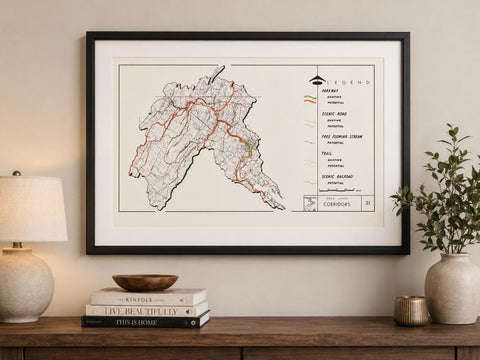
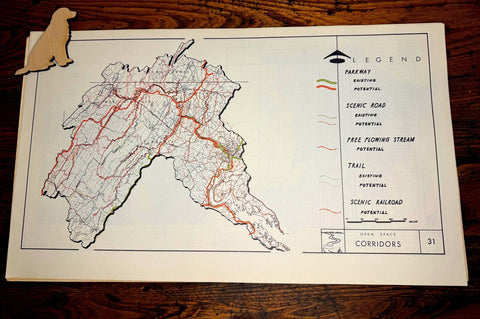
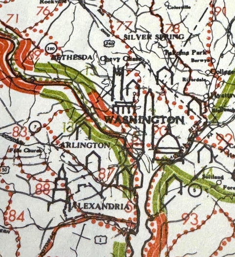
    This original vintage map of Open Space Corridors – Potomac Valley was printed in May 1966 as part of a study presenting the region as “a model of scenic and recreational values.”

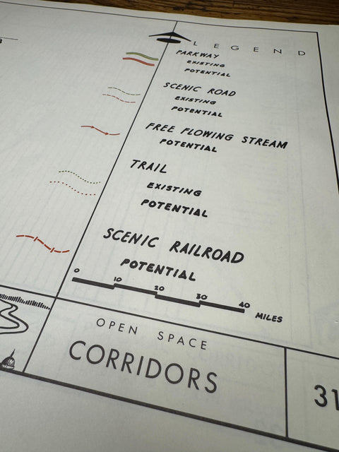
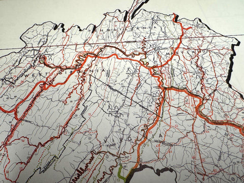
    The map covers the Potomac Valley region, including Washington, D.C. and surrounding areas of Maryland, Virginia, and West Virginia. It highlights open space corridors along the Potomac River and identifies scenic and recreational features such as parkways, scenic roads, trails, railroads, and free-flowing streams, with distinctions between existing routes and proposed developments.

    This piece reflects mid-20th century conservation and planning efforts, offering both geographic detail and historical insight into how the region’s natural landscape was envisioned for public use and preservation.

    This is an authentic vintage 1966 printing and not a reproduction. It retains its original character with light, age-appropriate wear.

    • Title: Open Space Corridors – Potomac Valley
    • Date: May 1966
    • Type: Scenic & Recreational Planning Map
    • Region: Washington, D.C., Maryland, Virginia, West Virginia

    Size:
    11.5 x 19.5 inches

    Condition:
    Good vintage condition. Please see photos for details. Frame shown in mockup photo is for display inspiration only.

    This map is part of a larger series. Additional prints from this series will be available in our shop.

    Your map will be carefully packaged to ensure it arrives safely.

    Share
    Share on Facebook X (Twitter) Pinterest
    ×
    Field & Maple Vintage
    Home About Contact
    Customer Service
    Privacy Policy Shipping & Returns
    Follow us
    FacebookInstagramPinterest
    Copyright © 2026 Field and Maple Vintage
    A Little Vintage in Your Inbox

    Discover new vintage finds, Field Notes, and occasional special offers. 

    Sign up and enjoy 15% off your first order.